Agrilyze is at the forefront of solving this problem for farmers by making agriculture smarter with the use of satellite imagery, AI and machine learning technologies for monitoring, detection, analysis, and prediction.
Get Insights for Your Farm
Leverage artificial intelligence to proactively identify farm solutions to critical farming problems.
The Problem
Traditional Processes
& Overwhelming Data
Traditional farming practices are area-focused. There is a general set of crops cultivated throughout an area. All the farmers in that area follow similar procedures with respect to sowing, nourishing, and harvesting. What these practices result in are crop volatility, overuse of resources, and unrestrained waste production.
Advancements in data analytics and IoT have created optimism for the modern-day agriculture sector, thereby combating the issue of unpredictability and providing farm solutions. Many farmers today have adopted the use of various precision farming applications. However, the problem still lies in their ability to decode the information being gathered.
Farmers around the world are asking themselves, “Okay, I have all of this data, but how do I use it?”
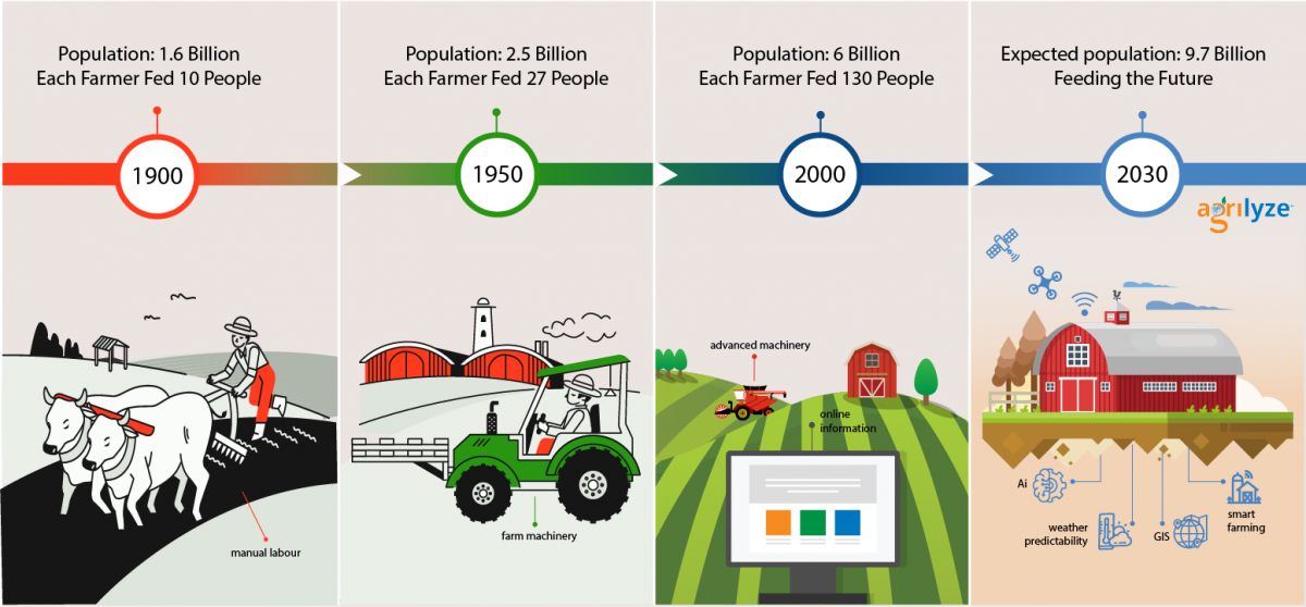
Past, Present, Future
The Evolution of Agriculture
The Solution
Spatial Technologies
in Farming Today
Agrilyze uses leading-edge spatial technologies and AI to produce visual representations of data while performing spatial and non-spatial analyses helping farmers make more informed decisions. A farmer can use such tools to explore various factors such as soil type, topography and even drainage planning. Furthermore, farmers can monitor crop health, the estimated yields from a given field and maximize crop production.
As the world’s population grows, we must meet the growing need for food worldwide; bottom line, this creates a drastic need to “do more with less”. Food production will need to increase by 70%, and the only way this can happen is through technology. The Agrilyze platform aims to transform the agriculture sector by impacting production levels, making it more affordable with better land resources management. Location information is critical to agriculture as it allows farmers to continually assess agricultural production status across a wide range of spatial applications.
Agrilyze’s Solution For Farmers
Modern Farming Made Simple!
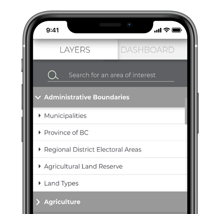
Data Management
Use the wealth of data to your advantage.
Keep your farm records and all data in one place. Get real-time insight into the daily progress of your crops and activities.
HD Visualization
Always have a visual of your farm.
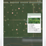
Get access to high-resolution satellite images for monitoring, GPS geotagging, and weather analyzing.
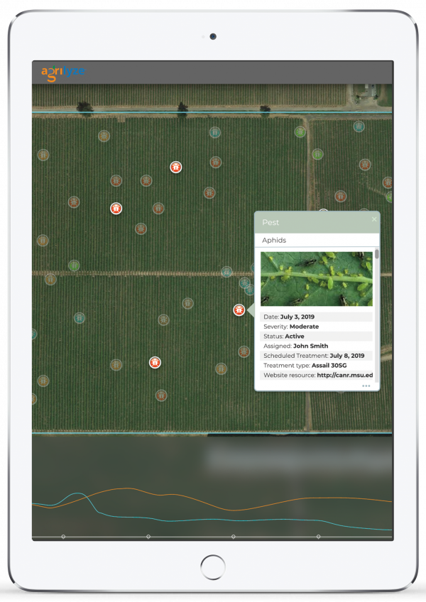
Pest Control
Avoid unnecessary spraying.
Agrilyze’s advanced image recognition technology identifies the type of invasive species. Don’t let insect pests and diseases thrive – our platform warns you if your crops are at risk.
Decision Making

Make smart and timely decisions to improve yield and profit.
A simplified dashboard displays critical parameters such as temperature, humidity, weed count, fertilizer usage.
Optimize Operation
Increase productivity in all areas.
Use any mobile device to manage sales, expenses, and cash flow while implementing best agricultural practices and complying with standards.
Work Management

Embrace high-tech farming effortlessly.
Very scalable, a single application for management of multiple farms. Our application enables integration with existing devices and IoTs.
Crop Protection
Easy Identification
Data capture with mobile device – add detail, location, photo via mobile device – such as capture a weed in the field and have it show up on the map; or add data from a moisture sensor.
Advanced image recognition as a farm solution to identify the type of invasive species/pest.
Stay Informed
Aggregated Data
Access document repository on mobile device, particularly best practices.
Access to localized legislation links specifically dealing with livestock, greenhouses, berries, beekeeping, cannabis.
All available public information on land use, topography, proximity to water.
Farm Mapping & GIS
Spatial Data
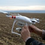
Remotely sensed data (aerial, satellite, drone) from a variety of sensors for image classification and change detection.
Farms (active or not) including building footprints with area of property and buildings, farmland, animal units.
Land usage and permits and onsite localized data sets.
Stay Safe Solutions
Fast Hazard Response
Show overlays of many layers related to farmer’s land such as hazards, topography, weather, flood, transportation, ground water.
Display dashboard with KPI’s such as temperature, humidity, evaporation, fertilizer usage, weed count, aggregated sensor information.
Smooth Process
Operation & Management
Groundwater monitoring and contamination data.
Organic material production and processing sites.
Work Management tool to track time, equipment, payroll, customer’s information.
Equipped for the Future
Optimize processes, increase profitability, make informed decisions, embrace the advantage of technology.
Book A Demo


Book A Demo