Code of Practice for Agricultural Environmental Management – Minimum Setbacks
It is important to set back agricultural activities from watercourses, drinking water sources, and property boundaries as it creates a buffer that protects water quality and neighbouring properties. Setback distances are dependent upon the specific agricultural activity. Here is the rundown provided by the Government of BC. (Source: https://www2.gov.bc.ca/gov/content/environment/waste-management/industrial-waste/agriculture/regulation-requirements/minimum-setbacks):
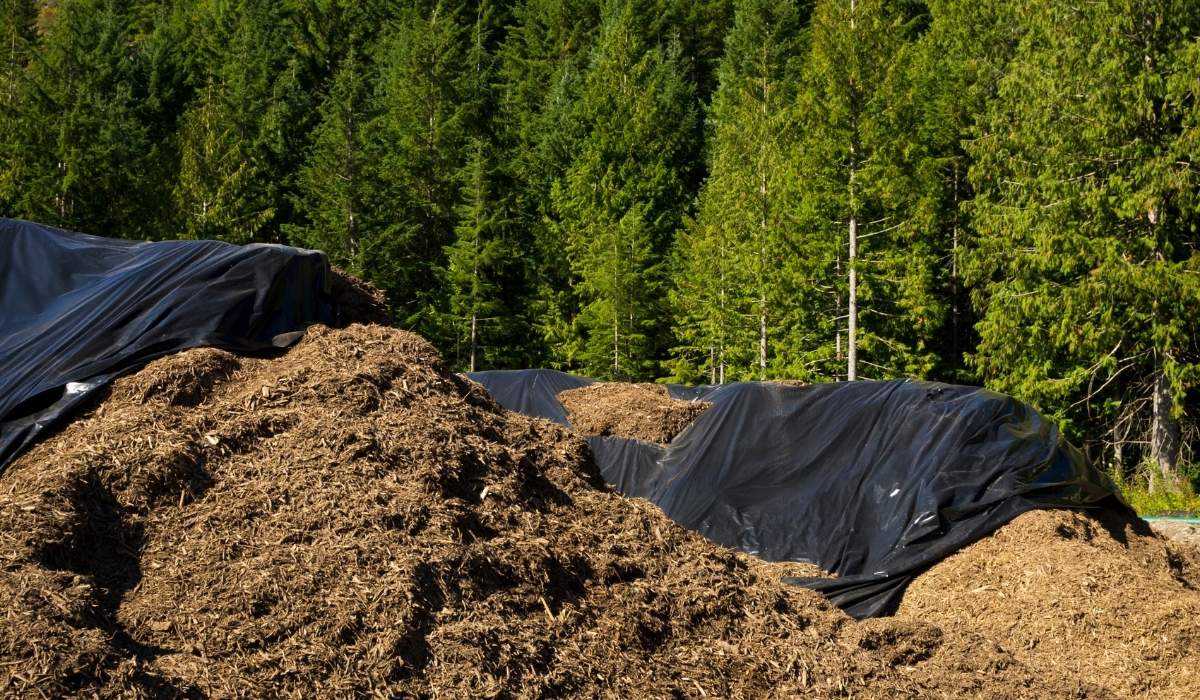
Agricultural Composting Processes
Composting structure:
- Drinking water source: 30m
- Watercourse, other than a drinking water source: 15m
- Property boundary: 4.5m
Outdoor agricultural composting pile:
- Drinking water source: 30m
- Watercourse, other than a drinking water source: 30m
- Property boundary: 4.5m
When Applying Nutrient Sources to Land
Other than wood residue or irrigation water:
- Drinking water source: 30m from a well or diversion point & 3m in any other case
- Watercourse, other than a drinking water source: 1.5m if commercial fertilizer or sub-surface injection is used, & 3m in any other case
- Not on the property boundary
Disposing of Processing Wastes or Mortalities
In a composting structure:
- Drinking water source: 30m
- Watercourse, other than a drinking water source: 15m
- Property boundary: 4.5m
Using an outdoor agricultural composting pile or burial pit:
- Drinking water source: 30m
- Watercourse, other than a drinking water source: 30m
- Property boundary: 4.5m
Using an incinerator:
- Drinking water source: 15m
- Watercourse, other than a drinking water source: 15m
- Property boundary: 7.5m
Feeding Locations
On-ground feeding locations or mobile feeding bins used in a seasonal feeding area:
- Drinking water source: 30m
- Watercourse, other than a drinking water source: 30m
- Property boundary: 4.5m
Keeping or Rearing Livestock or Poultry Using a Confined Area
< 10 animal units in which animals are fed:
- Drinking water source: 30m
- Watercourse, other than a drinking water source: 5m
- Property boundary:1.5m
≥ 10 animal units in which animals are fed:
- Drinking water source: 30m
- Watercourse, other than a drinking water source: 30m
- Property boundary:1.5m
Any number of animals, none of which are fed:
- Drinking water source: 30m
- Watercourse, other than a drinking water source: 5m
Property boundary: N/A
Note: 10 animal units are equivalent to 4,550 kg of livestock or poultry or any livestock and poultry combination that equals 4,550 kg.
Storing Manure and Other Agricultural By-Products
In a permanent storage structure, as on-ground under-pen storage or as temporary field storage of < 2 weeks:
- Drinking water source: 30m
- Watercourse, other than a drinking water source: 15m
- Property boundary: 4.5m
As temporary field storage of ≥ 2 weeks:
- Drinking water source: 30m
- Watercourse, other than a drinking water source: 30m
- Property boundary: 4.5m
Agricultural by-products include manure, soiled animal bedding, dropped or spoiled feed or silage, agricultural vegetative debris, a product of an agricultural composting process used mushroom-growing substrate, and used soilless media.
- Storing or Applying Wood Residue
In a permanent structure, or as temporary field storage, or applying wood residue to land in a layer measuring 30 cm deep or more:
- Drinking water source: 30m
- Watercourse, other than a drinking water source: 15m
- Not on the property boundary
Applying wood residue to land in a layer measuring less than 30 cm deep:
- Drinking water source: 30m from a well or diversion point & 3m in any other case
- Watercourse, other than a drinking water source: 3m
- Not on the property boundary
Pain Points
Setbacks are a way of managing nutrients properly to avoid any harmful damage to the environment. It also minimizes nutrient loss to ground and surface water. We will carefully examine Nutrient Management & Application in another blog post, so let us quickly review how setbacks can positively impact farming operations.
If crop nutrients are heavily applied, either from manure or fertilizer, nutrient requirements will be exceeded and will result in the buildup of nutrients in the soil.
If nutrients are not properly worked into the soil and are applied to the surface, they can be washed away by heavy rain or snow and even more so on sloping land. Then these nutrients can end up in ditches, streams or other surface watercourses. And if a significant amount of nutrients is built up in the soil and water over some time, resource quality will be affected. Hence, the necessity of minimum setbacks.
By understanding how various crop nutrients behave regarding their specific landscape, farmers can better understand how crops use nutrients and how they may impact the environment. Placement method is essential as it may significantly reduce the risk of nutrient losses.
Proper management of setbacks can keep nutrients in targeted areas as much as possible. It also serves as a defence line, keeping nutrients and other potential contaminants out of water resources. Maintaining setbacks can contribute toward protecting the quality of surface water, as well as preserving your land. It is crucial to keep track of several “health” factors like – type of vegetation in the area, what the health of this vegetation is, degree of erosion etc. Also, by managing or restricting access to grazing for confined livestock, you can help vegetation grow and thrive.
How Agrilyze Can Help
- With the Map my Farm setup at the implementation of Agrilyze, key features are identified (farm boundaries, field edges, watercourses, wells, storage facilities), and the appropriate setbacks are applied to give farms a clear understanding of the requirements
- Farmers can identify where nutrients are applied to allow for documentation for the Nutrient Management planning process as well as for historical analysis using spatial task management
- Links to guidelines and legislation are available in the software so farmers can access relevant details
- Tracking nutrient usage over time gives farmers a better idea of usage requirements, and perhaps other choices can be made
If you have feedback about this post or would like us to explore a particular topic, please let us know by sending an email to [email protected].
Read the Code of Practice for Agricultural Environmental Management – Introduction (with infographic) – https://agrilyze.ca/code-of-practice-for-agricultural-environmental-management-introduction/